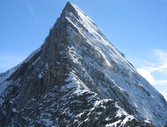
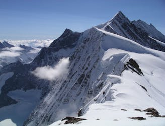
Schreckhorn Lauteraarhorn traverse
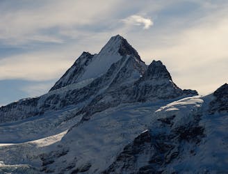
One of the finest and longest ridge traverses in the Alps, on great rock
Severe Alpine Climbing
- Distance
- 10 km
- Ascent
- 1.8 km
- Descent
- 1.6 km
A complicated approach followed by a great route on lovely red rock
Alpine Climbing Difficult

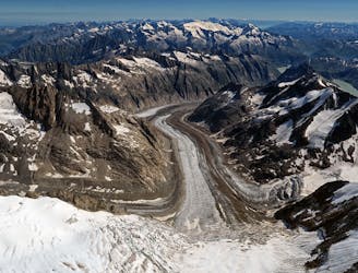
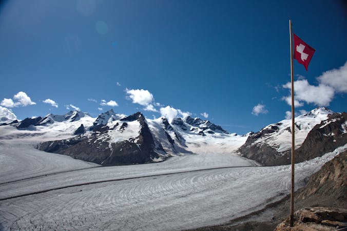
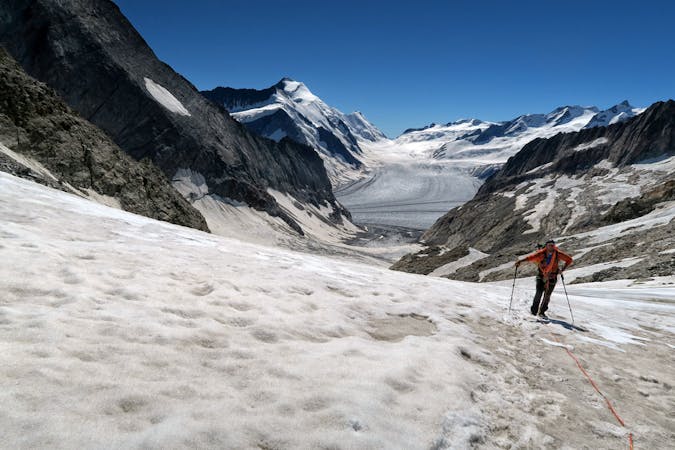
Descend on the path from the hut then fork L down to the Obers Isch glacier. Go up the debris strewn glacier to the S, to the base of the spur coming down from pt 2843m. Go around this then straight up, following scree and snow to 2950m, then via a steep ridge to Gaag at 3200m. Leave this path, which goes to the Strahleggpass, and go NNE to the Schreckfirn glacier, under pt 3428m. Take a rising diagonal on the glacier until you are below the summit itself, at a snowy couloir that splits the face. On occasions there may be large crevasses that split almost the entire glacier, needing a big diversion up R, before contouring back L across the glacier. Cross the bergschrund just L of the couloir, or in poor conditions head further L on the glacier before getting onto rocks.
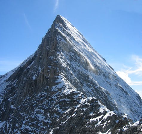
By either of these routes gain the obvious broad ramp that will lead up to the SW Ridge. The ramp may be easy snow but, if not, it is easier to cross to its far side and climb the rock, mainly UIAA 2 and occasionally 2+, to arrive at the shoulder at about 3750m. From here, after a short flat section, follow the ridge (with some moves of 2+ on good rock) initially on the R, then on the crest itself. There are occasional bolts and abseil rings. There is a further steepening below the summit. Traverse L here and climb a short crack which may be icy (UIAA 3-) then move back onto the ridge near a fore-summit. Easier mixed ground leads to the summit itself.
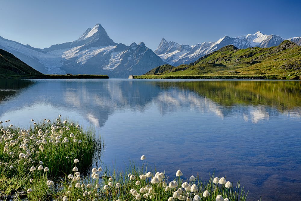
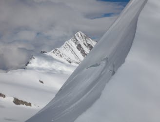
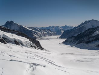
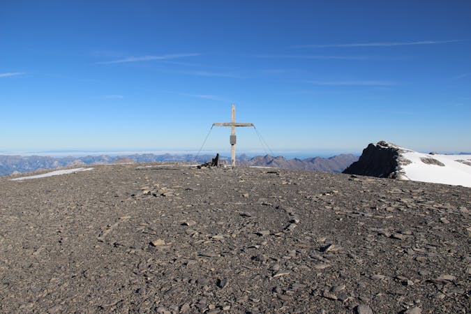
Admire the fine interconnecting ridge to the Lauteraarhorn and all the big peaks of the Oberland, including a great view of the distant Mittelegi Ridge of the Eiger.
Descent is the same in reverse. Printed texts suggest 50m abseils, but this is not needed and may cause rope drag, so do 25m abseils and avoid the need to carry an extra rope.
Difficult
The beginning of truly technical terrain which might involve pitched climbing on rock and/or ice, exposed terrain and complex route finding in ascent and descent. Equivalent to AD, AD+

Much of the route is difficult to protect and a fall could be disastrous at certain points.

In the high mountains or remote conditions, all individuals must be completely autonomous in every situation.
One of the finest and longest ridge traverses in the Alps, on great rock
Severe Alpine Climbing
4.8 km away
An enjoyable route (on slightly variable rock) to a fine summit with fantastic views
Difficult Alpine Climbing
5 km away
A steep snow climb and exposed ridge on good rock to one of the remotest 4000m peaks
Difficult Alpine Climbing
5.8 km away
One of the very best routes in the Alps, on a legendary peak
Difficult Alpine Climbing
6.7 km away

Two summits of 4000m that can easily be combined in a single outing.
Moderate Alpine Climbing
6.8 km away
A mega-classic route up the highest peak in the area
Moderate Alpine Climbing
6.9 km away
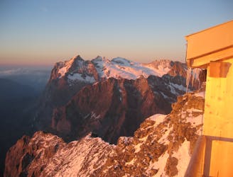
This hut approach is an alpine route in itself, to an amazing hut in an outrageous location
Difficult Alpine Climbing
7.7 km away
A high altitude glacial journey, to a steep col, then 2 quickly accessed 4000m peaks
Moderate Alpine Climbing
9.3 km away
A physically easy (ish) start to a high mountain adventure.
Easy Alpine Climbing
9.3 km away
A straightforward, stunning peak in amongst the giants of the Bernese Oberland.
Easy Alpine Climbing

11 routes · Alpine Climbing · Hiking
4 routes · Alpine Climbing
8 routes · Alpine Climbing · Hiking

6 routes · Alpine Climbing
10 routes · Alpine Climbing · Hiking

10 routes · Alpine Climbing · Hiking

20 routes · Alpine Climbing · Hiking
9 routes · Alpine Climbing · Hiking