25 m away
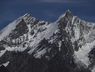
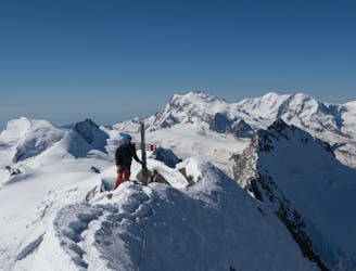
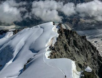
Lenzspitze Nadelhorn Traverse
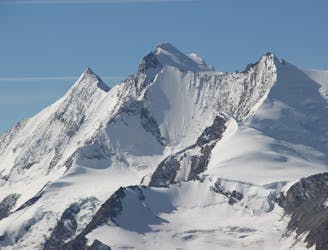
A great route traversing two 4000m peaks, with excellent rock towards the summit of the Nadelhorn
Difficult Alpine Climbing
- Distance
- 5.5 km
- Ascent
- 1 km
- Descent
- 1 km
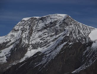
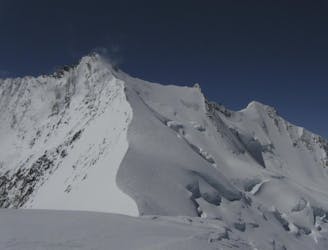
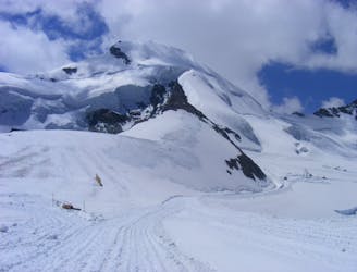
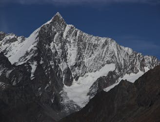
Nadelhorn from Mischabelhütte
Alpine Climbing Moderate

Rock ridge and glacier travel to the top of Nadelhorn. The Nadelhorn offers a beautiful and varied high tour. It is the highest peak of the Nadelgrat. It probably got its name from an oval hole, the so-called "needle hole", which is located about 10 meters northwest of the highest point. The ascent over the normal route belongs to the easier peaks of the Mischabel group if the conditions are good.
Moderate
May involve slightly more complex glacier hikes, easy but possibly long rock ridges and steep snow up to 45 degrees. Equivalent to PD, PD+

The route features some exposed and/or difficult to protect sections.
Away from help but easily accessed.
25 m away
A great route traversing two 4000m peaks, with excellent rock towards the summit of the Nadelhorn
Difficult Alpine Climbing
3 km away
A long glacial journey up a complicated glacier to a remote summit.
Moderate Alpine Climbing
4.3 km away
A famous and committing high altitude traverse between two mighty peaks
Severe Alpine Climbing
4.9 km away
A classic 4000m voyage ticking off 4 summits in day, each one higher than the previous
Difficult Alpine Climbing
5.5 km away
A long and impressive glacial journey to a remote summit, after a big hut approach the day before
Moderate Alpine Climbing
5.9 km away
Possibly the easiest 4000er in the Alps which enjoys spectacular views
Easy Alpine Climbing
6.6 km away
A long journey up a relatively straightforward snowy peak, popular in the spring too.
Moderate Alpine Climbing
6.6 km away
A beautiful summit with a characteristic sawtooth N Ridge, here climbed most easily from the opposite side.
Moderate Alpine Climbing
6.6 km away
A classic route and an aesthetic line.
Moderate Alpine Climbing
7.9 km away
A fantastic, classic mountain ridge climb on one of the most demanding Alpine 4000ers
Difficult Alpine Climbing

9 routes · Alpine Climbing · Hiking

11 routes · Alpine Climbing · Hiking

10 routes · Alpine Climbing · Hiking

6 routes · Alpine Climbing · Hiking

10 routes · Alpine Climbing · Hiking

9 routes · Alpine Climbing · Hiking

20 routes · Alpine Climbing · Hiking